The resort, at a glance.
Explore the resort map. Zoom in to read building numbers, restaurant labels and the map legend.
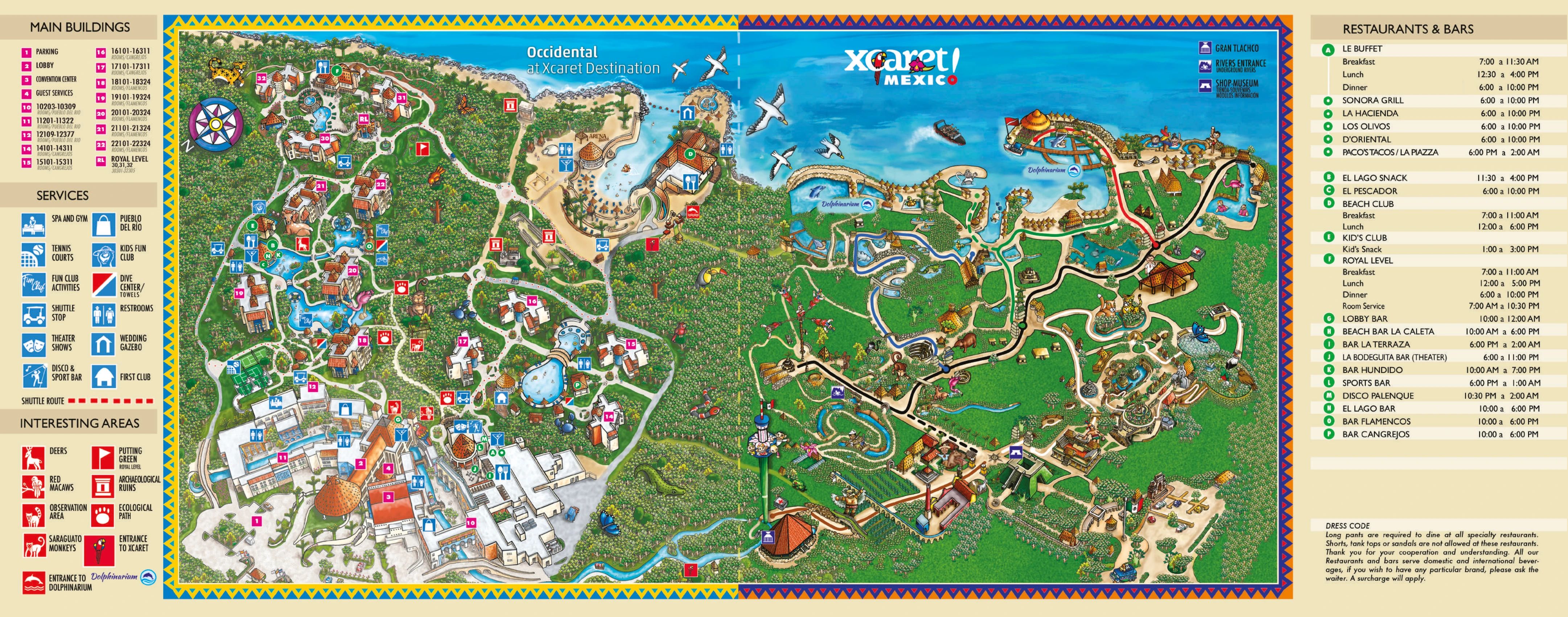
On a phone, use “Find a place”, or zoom and swipe the map. Tap an icon for details.Hover or tap the original map icons for details. Hover over a legend entry to highlight its location; filters highlight both locations and legend entries. A identifies Le Buffet. The dot beside A represents the six restaurants listed under the dot in the legend; it responds to both dining filters. Added pool numbers are temporary references, not official names. The red shaded Royal Level area is restricted access; its outline is approximate.
This is the supplied resort map. Names and hours printed on it may differ from the Food Options and Bars pages; check the resort’s current schedule.
Google Satellite
Open in Google Maps ↗Google Maps · Map data ©2026 INEGI · Satellite imagery ©2026 Airbus, CNES / Airbus, Maxar Technologies
Static copy, rotated and framed to approximate the resort illustration: sea at the top, Royal Level upper left, lobby lower left. Zoom and position are shared across all three views. The illustrated map distorts distances, so landmark alignment remains approximate.